BUZZARDS ROOST (2,150') AND CHALK MOUNTAIN (1,609') November 17, 2001
As
a welcome to my newly found companion Bob, I met him along Interstate
80 for a good day carpool and double hike in the vicinity of Big
Basin Redwoods State Park, in the Santa Cruz Mountains. It was
a pleasure giving a first ride in my new car, for what I hope
to be many carpools in seeking many, many summits about the West.
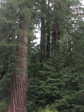
I motored speedily down I-680 to San Jose, and took I-280 to Highway 17. Then through Saratoga, CA, enroute to the western approach and the headquarters of this large State Park, I handily took on the curves and narrow roads. Arriving there at about 8:50 a.m., we shortly took the Redwood Trail by 9 a.m. to start what I hoped to be an interesting, but short, climb. Navigating up a couple different named trails, Bob was useful in knowing things that helped on taking the proper way to the summit. He is an accomplished Bay Area hiker and is hoping to investigate peak climbing as a hobby. I am only too glad to assist.
Coming by 10:10 a.m. to the summit of Buzzards Roost, I noted that an unnamed, forested bump a quarter mile to the southwest was higher, so put me in doubt that I could count this as a true peak. A ten foot high pinnacle perhaps constituted the actual highpoint of the Roost, and Bob handily climbed it. I checked the moves out carefully, and left it for another time. I'd rate it high 3rd class, and with our need to hurry along, with my fears of an injury as on the previous Nevada trip, and also the topologic uncertainty to call this a peak, I'd save myself any embarrassment from getting stuck on an awkward downclimb.
I shot pictures with my back-up, film camera, as I had failed to correctly calculate the charge left on my two batteries, so couldn't much use my digital camera. We knew we were doing so well on time, I supposed, to drive about another 40 or so miles to the start for Chalk Mountain.
Leaving the park headquarters parking by
11:40 a.m., I looped over back to Highway 9 south and then through
the village of Bonny Doon, and then did an unnecessary road loop
following a bad road atlas. We finally came to Highway 1, and
I pulled off at the Rancho Del Oso Nature Center looking for information.
The ranger wasn't around, so I had to rely on Bob's memory for
the correct dirt road to the trailhead for Chalk Mountain.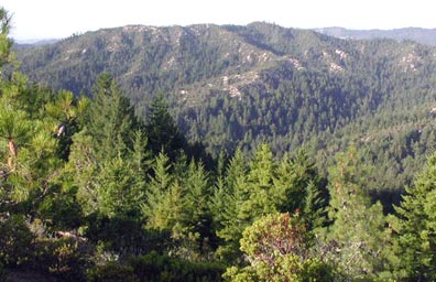
He passed his navigation and memory test with flying colors, and I drove up the Whitehouse Canyon Road, not signed, a couple miles on partly slick, damp, dirt, to the signed trailhead. I assumed it would be an easy hike by my information, but no one knew the stats exactly. We started at 1:36 p.m., up through dimly lit, thick groves of conifers, with redwoods, and took the steep trail with gusto. By our maps, it looked like today's plans would be a success. I regretted that my digital camera could only be used for a few shots, but with the poor lighting conditions deep in the forests, I wouldn't have gotten too many great shots anyway.
There are two signed vista points, then
in 1.5 miles, we came to the Chalk Mountain Road. This leads quickly
to the highest point, with a benchmark, but a small peak a half
mile or so to the east was designated, on the map, as the named
point. We climbed both of them to make sure, by 3 p.m. They both
had antennas and facilities on top. Knowing we had completed our
goals with no rush to hike back, I shot more pictures, and savored
enjoying this new area, for me, and mentioned to Bob my thoughts
about "counting" these as "peaks."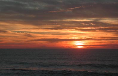
We came back to the car by 4:21 p.m., and quickly motored back out to Highway 1. We enjoyed a magnificent ocean sunset, and then took Highway 92 through the town of Half Moon Bay, and then over to I-280. Caught in a traffic jam in San Francisco, we made it over the Bay Bridge, and I dropped off Bob by about 7:35 p.m.
I had driven some 350 miles, and shot well over a roll of Kodachrome, but only some 16 digital images. We had done some 11 miles total with some 2,400' gain.
I feared the trails would be slippery or muddy, but they weren't too bad yet. No bugs or ticks pestered us, and the steep climbing dictated stripping to T-shirts. The more humid ocean air caused considerable perspiration for me, but this was a good, mostly sunny, day of hiking, with now days of rain forecast for the week ahead.
BACK TO PETE'S THOUSAND PEAKS HOME PAGE