March 27, 2014
 This day, Thursday, would wrap up my crossing traveling, with some anxiety, as I had to ask for information on some of the roads. The New Mexico Department of Transportation had replied to my e-mail queries, with good information, but they couldn’t say about Navajo highways. Navajo DOT has a website but surfing didn’t provide exactly what I wanted to know.
Up early, I headed east on Interstate 40, for a crossing that I think that I already had done, but took pictures, anyway. Exiting at Thoreau, NM, I took a drink stop and break at a store, then headed north on NM 371. Looking for Navajo 49, I didn’t see a sign for that, but there was a road heading for Mariani Lake. There is a crossing on this highway, but I was to come back later to dot the “i.”
Setting video with new snow headed north on NM 371, I got that, then came to Crownpoint, NM. A supermarket made for a stop, then I inadvertently took Navajo 9 and NM 471 west. Going about 20 miles before I realized my mistake, I saw plenty of Navajo country though, and then came back to Crownpoint.
Taking the right road north, I then came to Navajo 9 east. It is a long way to Cuba, NM, the only main town on the far side of this remote stretch of high desert. The road was good, so I drove along, keeping track of the miles. Heading a jog south then on NM 509 to about and past Hospah, NM, it seems to have a crossing or two. It showed as paved on my AAA map, so this had to be done. I set video, and that went fine. Turning about at a energy site, I went back to Navajo 9, and set video for another crossing. The CDT goes further south along some ranges, as I don’t see how anyone would like to hike through this territory, with no water and barren, desolate country. There were no Divide signs about here, but I came then to NM 197, and appreciated the survival for the people that still live about here.
Finally coming to Cuba, NM, I took a stop at a fast food eatery, so gratefully. To U.S. 550, I set video for another crossing, and there was a sign. Turning back to go to NM 96 north, I stopped in Regina, NM, to speak with the help at a general store. She gave me information about the roads, as NM 595 does not go through. NM DOT had said that they never heard of a Burford Lake, shown on my map, and that the road dead ends at a certain point. I resolved that the crossing on NM 95 further north past Lindrith, NM, was not enabled to be reached. So, then I had a crossing on NM 595 just west of NM 96, that was to be the last one on my list. I’d check later if I needed to come back to do the northern one on NM 95, if it did exist. That would go with a fall trip to cross over Wolf Creek Pass, in Colorado, for the colors, whenever. I motored the mile or two over this crossing, with no sign, but known to the clerk at the store.
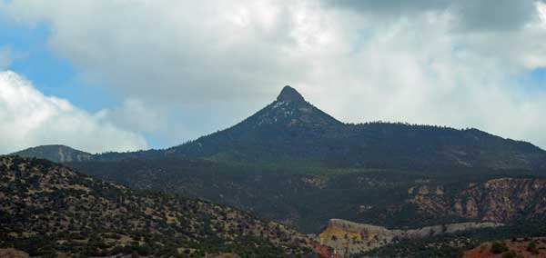
Done, I returned to NM 96, and headed east and south. Scenic, then Abiquiu Reservoir made for a pretty sight. To U.S. 84, I headed southeast, to my lodging in Espanola, NM. Sights of the distant, snowy, high peaks probably included Wheeler Peak, the highest of the state. So, my eccentric ambition had been fulfilled for New Mexico, to the best of my knowledge. Maybe some one will come forward to tell me about some paved road that has a Divide crossing that wasn’t on my AAA map, or perhaps in years, I will return to do forest dirt roads to complete additional crossings. This was great, being safely and uneventfully done!
To my motel, I researched for dining, and getting lost a bit, searching by car, found the place, and ordered shrimp. Nice to be able to afford fine dining, as it adds to the enjoyment. There had been panhandlers, and poor people, even this way, but as they say, “a hand up, not a handout.” My policy is no money to strangers, as it can be fueling the drug trade, or crime.
2014 New Mexico Road Trip Home, 23, 24, 25, 26, 27, 28, 29, 30, 31, 1, 2, Movies
BACK TO PETE'S
THOUSAND PEAKS HOME PAGE