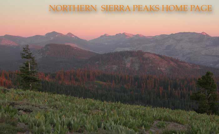
A sunset view to the Crystal
Range from the Ellis Peak Trail. Photo taken August 12, 2003,
by Petesthousandpeaks.
NORTHERN SIERRA PHOTO GALLERY
Northern Sierra Peaks Guide
WHAT PEAKS
TO CLIMB?
 Novice
peak climbers might start doing the easier ones, with official,
graded, trails built up to the top. Sierra Buttes, Mt. Lola, Mt.
Judah, Mt. Rose, and Thunder Mountain fit this category well.
You will have to closely read the route descriptions to determine
that many more of these "wild" peaks have trails or
use trails going close to the top.
Novice
peak climbers might start doing the easier ones, with official,
graded, trails built up to the top. Sierra Buttes, Mt. Lola, Mt.
Judah, Mt. Rose, and Thunder Mountain fit this category well.
You will have to closely read the route descriptions to determine
that many more of these "wild" peaks have trails or
use trails going close to the top.
Moving on to a challenge,
one might strive for height, generally looked for in the southern
summits. The peaks get higher, on average, as one looks southeast
along the Sierra crest. Technical difficulty is found with Da-ek Dow Go-et Mountain and Thimble Peak, both class 4, or Round Top and Castle
Peak, with their considerable sections of class 3 route-finding.
Spectacular views can come
from popular peaks like Mt. Tallac, with its tough trail to the
panoramic vista of Lake Tahoe, or Highland Peak, with the pristine
Carson-Iceberg Wilderness about.
Good winter ski ascents
are found in the class 1 or 2 peaks near the major plowed highways.
Ralston Peak seems to be skied often, and one of my favorites
is Rubicon Peak.
I've rated Silver Peak
(south) as the overall most difficult peak, with its large amount
of trailless gain, even though it doesn't exceed class 2. Nearby
Highland Peak does have its use trail, and the PCT runs by it
more closely.
With a good vehicle, one
could nearly drive-up Genoa Peak, or buzz Ellis Peak with a dirt
or mountain bike. If you like to combine fourwheeling with hiking,
the desert peaks like Mt. Como and Mt. Siegel offer vastly different
terrain than the Sierra. For plain solitude, some seek out the
Sweetwater Mountains, which most hikers ignore. The area about
Sonora Pass and Ebbetts Pass is the furthest from the major cities,
so tend to be less visited, to the delight of backpackers and
hunters.
Most climbers work on a
peaks list. The entirety of this guide offers a "list"
that only a few have completed, and is beyond most, but for the
most determined of summiteers. Many summits will have registers,
which should be signed, if you wish to be credited by whatever
peak climbing group. The "leave no trace" entreaty applies
to other, more natural, features. Most of us don't buy the glib
explanation for your signature's absence that it was too hard
or immodest to put your "proof" that you were there.
More than likely, you never climbed it! No summit photos don't
"prove" your ascents, either! Due to the advent of what is termed, "photoshopping," I now record my ascents for posterity by a "summit twirl." It seems impractical and improbable that someone would "fake" HD video for a peak ascent credit. Many jurisdictions now disallow summit registers, by them. My word is that rangers are sent to remove them. Suggestions on how to perform a video selfie to show that a climber is truly atop a peak is described in a link at the Nevada Peaks Club pages. Examples of my own summit twirls are viewable on my videos captured atop a summit. With presently inexpensive cameras or smartphones, I fail to accept that for any "proof," this is not widely adapted.
"Wag Bags" are now available from certain ranger stations (about $3, 2012). I now use plastic shopping bags, doubled up. Please have some ready to help preserve backcountry water quality, if needed, and do pack them out. I am not told if there are any official places to leave them, but by some laws, you can dispose of them into some garbage containers headed for a public landfill, if done in a sanitary fashion. The easy way to deal with human bodily waste is to use a proper restroom facility before your hike or climb, clearing out your system. Some businesses enroute offer the opportunity, with a customer purchase. Some official trailheads also have facilities, so please use them as a last resort. The USFS supports, "Go before you go." It is possible to do any peak without any pollution. Due to my own personal concerns, I have been using a "pee" bottle. This is practical during day climbs. For the most part, aside from footprints, my peak bagging is near zero impact. I now drive a zero emissions vehicle, with a CyberTruck to come.
Yes, there are climbers
who just wish to meet people. The ones with the trails would appeal
more then, so the peaks that start at official trailheads would
seem to offer better ops for social contact. For some reason,
Pyramid Peak gets climbed a lot. Freel Peak is done now via the
Tahoe Rim Trail, so look for your "company" there, too.
Many people will want their
namesake mountain, or perhaps just climb what they've been seeing
from town all their city-bound lives. The reasons to climb a peak
may stretch from "because it's there" to "why not?"
But for most, you will not summit as part of a carefree hike to
head somewhere. Going to the top of a major Northern Sierra peak
requires forethought and planning. Study your opportunities prior
to setting out, and know your own ability lest you become another
statistic. There are thousands of bumps to qualify as highpoints,
but only a few of them are worthy, named peaks.
I sincerely hope that this
brief transgression upon picking favorites might help you on what
will hopefully be the best summer or winter wild escape you will
have ever had! Climb smart, and be safe!
ENTER
THE WORLD OF THE NORTHERN SIERRA PEAKS GUIDE!!
BACK
TO PETE'S
THOUSAND PEAKS
HOME PAGE