FISKE (2,868') 5X December 26,
1999
 The forecasts
of continued dry, sunny winter weather led me to repeat, for my
fifth ascent, this relatively easy
coastal range summit hike starting from the Cache Creek Canyon
Regional Park along Highway 16. I started at 11 a.m. to take the
dirt road over the low water bridge, and then left onto the trail
constructed by the local Sierra Club and the Boy Scouts.
The forecasts
of continued dry, sunny winter weather led me to repeat, for my
fifth ascent, this relatively easy
coastal range summit hike starting from the Cache Creek Canyon
Regional Park along Highway 16. I started at 11 a.m. to take the
dirt road over the low water bridge, and then left onto the trail
constructed by the local Sierra Club and the Boy Scouts.
The trail ascends steeply along grassy
and chaparral-laden hillsides. It takes many a short, steep dip
through rocks and around trees as it climbs up to the main Blue
Ridge. The elevation gain to the peak is over 2,000 feet. Many
hikers will consider this "rough."
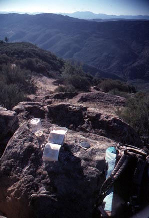
The summit area is defined only by two
benchmarks. The vistas extended today to Mt. Shasta to the far
north, and Lassen Peak and the Northern Sierra to the east. Many
Coast Range peaks are seen to the north and west. The Sutter Buttes
rose above the Central Valley fog. This is a nice place to view
golden eagles, being prime nesting habitat.
It took me 2 hours and 12 minutes to complete
my ascent, then some time to look through the register.
It took about two hours to return to the car, including time to
talk to other hikers. This area is under the jurisdiction of the
Bureau of Land Management, and is considered by some a prime candidate
for wilderness designation.
BACK TO PETE'S
THOUSAND PEAKS HOME PAGE