MOKELUMNE PEAK (9,332') 5X June 8, 2001
Meeting
another member of the Sierra Peaks Section in Jackson, CA, we
saved gas by carpooling up Highway 88 to the Bear Valley Reservoir
Road. Having responded to my e-mail or website plea for climbing
partners, John sought to do this fairly remote Northern Sierra
peak, which has a complicated drive and approach. He reports seeing
this prominent peak most everyday from his Central Valley home.
Many things had changed since my last ascent in 1997. I kept notes for the Northern Sierra Peaks Guide, and realized one could be confused by my outdated, now deficient, directions.
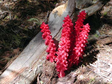
We started 0.3 mile short of the Tanglefoot Trailhead, due to badly overgrown dirt road, by 9:46 a.m. This newer peak climber did very well, and we made great time. We saw many snow plants along the trail. Descending into Tanglefoot Canyon, we easily crossed the creek, and began climbing on the trail up the eastern canyon wall. The trail was very rough, and beginner hikers would have a hard time. We came to Moraine Lake, having met two backpackers who had stayed there overnight.
The weather was very nice. A cool breeze aided the exertion, and helped blow away the many mosquitoes. I hiked in shell pants, figuring the brush on the cross-country section would be sometimes unavoidable. It was to get warm today, so I had shorts underneath, but never took off my long pants.
A couple miles past the lake, I chose to
leave the trail early to head for the easy bench to walk along
the side of bump 8,628', and then gain the ridge. This we did
without heavy brush this time! Some snow made to refill my canteens,
and the views were already great. I sent John ahead, since the
peak is obvious here. 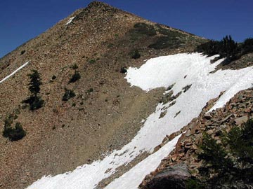 I
shot a picture of a snowbank, then plodded up the final rocky
section to reach the top at 2:03 p.m.
I
shot a picture of a snowbank, then plodded up the final rocky
section to reach the top at 2:03 p.m.
John had waved, and we did high fives. We were the first signed-in for the year!
The view was fairly clear, with part of the Central Valley seen. I digitally photographed, in sections, the 360 degree vista for later use, to be stitched together for a scrollable, long panorama for my website. Two SPS books were in an SPS aluminum cylinder for the register, and I was pleased all climbers helped to preserve this record of ascents. Being my 5X, I checked for my older entries, and one page had been missing from a book I placed. That does happen due to repeated handling.
We stayed about an hour, and John thought it was great. The local chapter claimed this peak is a three day backpack, but we had summited in some four hours. We relaxed, and I had a energy bar. It was then time to head back. We followed the ridge and our bootprints, and came back to the trail after an hour.
Now, it was a matter of hiking back to
the car, some 6.5 miles. Having watched for rattlesnakes, I decided
there wouldn't be any today, and John went ahead to climb the
500' or so back up the canyon wall, and then we had it in the
bag.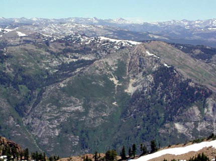
Back to the car at 6:30 p.m., I rushed to avoid mosquito bites, and we hurried off to arrange gear and repack elsewhere. I kept more notes on the mileages, and hope to have a clearer description of the drive on this route.
New blacktop had been laid, and we enjoyed the fine USFS road. It was once so potholed that it was dangerous. On Highway 88, we stopped at Hams Station for drinks and a phone call, and came back to Jackson by about 8 p.m. Shaking hands, we were determined to do more peaks in the future.
This hike is some 16 miles with 3,700' total gain round trip. I shot 39 digital photos, mostly of the view. It was T-shirt weather, and I drank some three liters of water. A windbreaker would have been good for the summit.
BACK TO PETE'S THOUSAND PEAKS HOME PAGE