 BIG
MARIA MOUNTAIN (3,381') AND SPECTRE POINT (4,400+') January 28-29,
1995
BIG
MARIA MOUNTAIN (3,381') AND SPECTRE POINT (4,400+') January 28-29,
1995BIG
MARIA MOUNTAIN (3,381') AND SPECTRE POINT (4,400+') January 28-29,
1995
Our scheduled DPS trip to do Chuckwalla Mountain was thwarted by a closed county road. We found this out as we met to drive to our peak destination. Thinking quickly, we decided to climb, instead, Big Maria Mountain, about 50 miles away by Interstate and rough road. The DPS Road and Peaks Guide gives hiking times, which was a great help in planning to do this alternate climb.
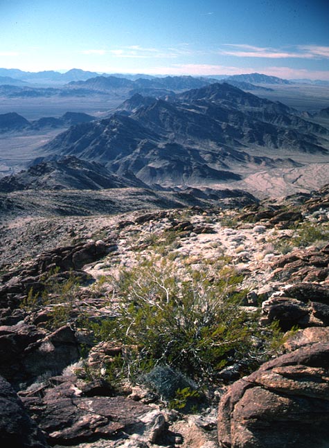
Taking a very rough road along some power lines, we bounced our way to the start point for the hike of this range highpoint. The climb up a wash was scenic, and I took pictures, while rushing along to keep up with the group. We came up on a ridge, then hiked along to gain the true summit.
The view to the west included the Little Maria Mountains, and Rice Valley to the north. We didn't have much time to linger. We were able to return to our vehicles by dark, though.
After unsuccessfully attempting a road shortcut, we were so tired. Driving back into Blythe, CA, we ate at a restaurant. This gave us more nighttime hours to drive over to the road for the next peak, Spectre Point, which is in the far eastern part of the new Joshua Tree National Park.
The sunrise on some hills to the north made a waking photo for me. The road here was slated to be closed, but the "red stakes," the vehicle closure sign of the wilderness boundary, weren't placed yet. This saved us about four miles of hiking, each way. These stakes would turn an easier peak into a long, long day.
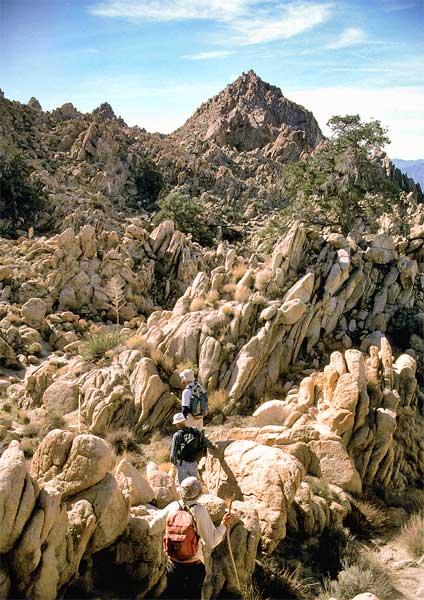
The leader took us cross-country over large boulders to a notch. We passed through, and dropped into another large gully. Our maps were bad, so, uncertain, the leader climbed a small peak to find a register. This clued us as to our exact location, and we were able to head for the exact highpoint of this rugged and beautiful section of the Park.
This is my favorite, scenic, California Desert range, deserving of protection to remain wild for all time. Dozens of pinnacles spotted the ridge of this range, and they can be seen from afar. My guess is that very few persons visit this part of the Park, and only the DPS takes people to explore and enjoy here. No trails or use trails were seen anywhere here.
Reading through the peak register, I saw names of some I had known from the local chapter. They deserve credit for their independent navigation effort, which I have seen sometimes is not so good.
 We
had our lunch on the summit, and I snapped many
photos of all the sharp sub peaks all about us on this fine
day.
We
had our lunch on the summit, and I snapped many
photos of all the sharp sub peaks all about us on this fine
day.
Again, we retraced our up route. We came back to the cars early enough for a last daylight look back from the junction of this now closed, sandy road and the paved highway.
Our whole group had a pleasant meal together in Twentynine Palms, and once again, the two of us had our long drive home.
BACK TO PETE'S THOUSAND PEAKS HOME PAGE