 Usually,
when I am on a road trip, I just know to start getting up at a
good hour. But at home, I usually have no pressing needs. This
had to change.
Usually,
when I am on a road trip, I just know to start getting up at a
good hour. But at home, I usually have no pressing needs. This
had to change.DONNER PEAK (8,019'), MT. JUDAH (8,243'), MT. ROSE (10,776') 12X, BASIN PEAK (9,015') 11X July 6-8, 2010
Since I supposed that I would no longer do very much of this, but then I had my offers on my website till recently, I had a couple guys wishing to climb some peaks as I had said and wanted. I know the way, and it would be a shame if someone became lost, hurt, or killed, from my not being there. I preach safety, and can teach some of my backcountry knowledge and expertise, by me. I therefore sought to come out of the retired state that I presumed, since so very few came to me to climb, hike, or ski. I had to restart my climbing. Going for a day trip, I would have to start waking up earlier. It used to be that I'd get up at 4 a.m., to have no one to climb anything. Now, I am sleeping late.
Usually,
when I am on a road trip, I just know to start getting up at a
good hour. But at home, I usually have no pressing needs. This
had to change.
I got up at about 8 a.m., Tuesday, the 6th, and made my reservations for cheaper, mid-week lodging, with my $10 coupon for a night. I loaded my car, and drove onto Interstate 80 eastbound. I made my photo stop at Yuba Gap, then used a restroom and bought a soda at the Soda Springs Exit.
Finding that new, still on-going, road work and construction would change my peaks guide directions to the PCT trailhead south from Old Donner Pass, I kept some notes to check again later. They have put in a new, paved road, and some construction has altered the original dirt road access. Because of the work, I couldn't take photos to back up my observations. I nevertheless parked my car at comparatively far different ops than were here before. The numerous "No Parking" signs about this road indicate the trouble some landowners have with hikers, perhaps.
Beginning my hike at 11:45 a.m., I saw that more trail construction was underway on the talus sections of the Pacific Crest Trail. They let me pass, and I shortly came to the trail junction to take to get to Donner Peak, this marked only by a metal pole. In the past, a good sign pointed out the Mt. Judah Loop.
Water, mud, and snow might turn many a hiker back. I had my ice ax, as on all of these hikes, and it helped. Passing some hikers, I soon followed the trail over snow, and then came to the turnoff for the use trail to the top of Donner Peak. I don't like counting these two wimpy peaks, but I have to get started doing this again. I had figured on waking up late, and I knew that the loop takes me only some 4 hours round trip.
It took me an hour to bag my first peak for the year. Other hikers were on top. I had a large book to use as the new register, with a metal box already there, nicely sized for it. I snapped my photos, and relaxed.
Descending back to the loop trail, I took a shortcut to the top of the Mt. Judah ridge, that avoided the snow. Lots of wildflowers! I topped both bumps of Mt. Judah, and captured more vistas. Alone, there was nothing to keep me here.
Seeking to complete the loop, I hiked down to the PCT, and found many snowbanks to have to hike about or over. I had to inform some backpackers, none with snow gear. Back to my car at about 3:10 p.m., I had lots of time to get to Reno, NV.
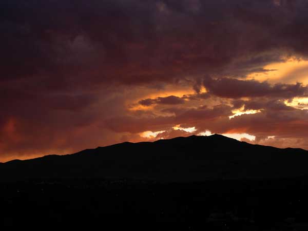
Refreshing myself with drink in Truckee, I stopped at my favorite outdoor clothing store, and got another T shirt, and a regular shirt, on sale. Then, it was to my hotel, and to dine, relax, and see a nice sunset. It would have been excellent if I had free Wi-Fi for my room.
Getting up at another good hour, Wednesday, I beelined for another fast food eatery and its free Wi-Fi. This was one of the best online travel experiences that I have had. I got the news and information as I sipped my drink.
Motoring up to the large paved trailhead of the Mt. Rose Welcome Center at the NV 431 highway summit, I used the facility and started up the trail by 8:50 a.m. Using the hikers trail, I soon ran into snow, but it was all passable. I came to the waterfall, and then to the trail junction. I was my old self, climbing peaks again! Some hikers were already coming back down.
Noting the mediocre wildflower display compared to other years, I climbed up the trail. Passing three other hikers, I started to gain the views. To the top alone, at 11:42 a.m., I began to snap panoramas. I donned a light pullover for my extended stay on top, and other hikers came up. I enjoyed speaking with some of them, and watched the changing light on Reno and Lake Tahoe, and the building thunderheads to the south.
Then, it was time, at 1:04 p.m., to start back down. I saw more photos to take, and a few more hikers were still headed up. I captured the clouds to the west and south. A magnificent display! Back at the falls along the trail, I shot a few movie clips (640 x 480 pixels, 0:33, 120 MB).
Back to the car at 3:38 p.m., I motored back to the fast food eatery for more drink, food, and more online surfing. This was great! Checking some libraries as I drove back north, I couldn't get any California newspapers.
Washing up and changing clothes, I had soup, and then a milkshake, this night, with another good sunset. Losing a few dollars gambling, I was having a good time.
Thursday, I got up early again, recorded the morning view, checked out of the hotel, and went straight to the free Wi-Fi access at the fast food eatery, for another good time with breakfast, surfing the Net, and using my apps. Motoring west on the Interstate, I shortly came to the Castle Peak Exit to find parking at the PCT trailhead.
Mosquitoes were biting, so I applied repellant. I started at 9:05 a.m. The Pacific Crest Trail north is very poorly marked. No signs to tell me the old way. They have changed the route, unknown to me, then. I hiked right (east) on the lesser dirt road, one track newly bulldozed. I failed to determine if my old guide directions could be followed as I had written, and headed cross-country in the trail's direction, as other hikers seemed to be doing that. I did find the old trail, and followed it along northward. It was poorly maintained. No signs to tell you anything till coming to a dirt road, as I had described before.
Finally, I came to the main trail stemming from the main dirt road up canyon, and all then was as I say. Perhaps a few new sponsor signs. Resting then at Castle Pass, I decided to go for Basin Peak, and not Castle Peak, or both. I had developed some qualms about climbing class 3 solo.
With more snow, I hiked down to Peter Grubb Hut, and met some backpackers. Their dogs barked loudly, and at first, I thought that they might be lost. I soon went on, and had to jump a creek. The PCT north was under snow, and I had to find my way through the trees. Shortly rising to cleared ground, I was able to find my way on the trail. I met two more hikers, and then headed up, and cross country, to the top. I was there at 12:25 p.m.
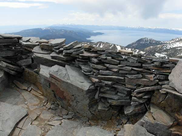 There
is a sign and register, and I recorded the views.
I had reserved an option to traverse over to Castle Peak, but
with no companions, I nixed that. I could see some hikers on the
use trail along the Crest ridge, but they were stopped and didn't
seem to be climbing this peak.
There
is a sign and register, and I recorded the views.
I had reserved an option to traverse over to Castle Peak, but
with no companions, I nixed that. I could see some hikers on the
use trail along the Crest ridge, but they were stopped and didn't
seem to be climbing this peak.
Heading down shortly, I had a sight of the cornice as well as the trail back. I intersected the PCT again, and followed it back down south.
Letting down my guard as I was some 10 minutes from the hut, I made a mistake, and slipped badly on some trail mud. The side of my head slammed into a rounded rock, and bent my glasses. Dizzy, I thought that I might be had. I wiped my head with snow, and saw blood. I composed myself, and walked the remaining few hundred yards to the hut. Hikers were having lunch, but I seemed O.K. to them.
Hiking back up over the pass on snow, one hiker offered assistance. He stayed with me to make sure that I didn't pass out. I wasn't bleeding much, if at all, and another hiker said my glasses took the brunt of the damage. I had some trouble seeing with my frames slipping loosely, then I slipped, on snow, again. I got to Castle Pass, rested, and had some water. Other hikers were resting there, too.
The clouds got darker, and I started to hear thunder. I ambled back south on the main dirt road, all downhill, which had a lot of snow at places, too. Now really wary of the snow and mud, I let some equestrians pass me. I snapped a picture of the dark clouds over Castle Peak.
Back to my car at about 3:30 p.m., I washed up with some spare water, and motored on my way. Only then four peaks for the trip. I stopped at Yuba Gap for more cloud pictures, and again at the fast food eatery for more drink, food, and free Wi-Fi. I had a slight nick on my face, and I will have to get my glasses fixed.
Total, I had hiked 23 miles, and climbed some 6,000 feet of gain. I captured about 750 images, and spent about 77 dollars cash, charging up nearly $80 for two nights lodging. Paying $27 for new clothes, I kept the driving down to 327 miles.
I sure liked my handheld with free Wi-Fi, and will start every day, while on the road, this way if I can. I will like doing more local peaks, too, although with the snow, water, and mud, many hikers may wait a month, or so, for the trails to get better.
BACK TO PETE'S THOUSAND PEAKS HOME PAGE