LAKE CLEMENTINE LOOP December
10, 2005
 Rather morose
after having to cancel from a DPS trip this weekend, I sought
to use my charged up, digital camera batteries on this local,
light hike. Making my arrangements to move, better, I left home
by about Noon to head eastbound on Interstate 80. So many cars
on the road!
Rather morose
after having to cancel from a DPS trip this weekend, I sought
to use my charged up, digital camera batteries on this local,
light hike. Making my arrangements to move, better, I left home
by about Noon to head eastbound on Interstate 80. So many cars
on the road!
Coming to the parking along the Old Foresthill
Road, I readied my pack and took off by 12:53 p.m. The Lake Clementine
Trail heads up river along the North Fork of the American, and
a few mountain bikers passed by. The river water appears a bit
cloudy, contrasting with the Middle Fork. I was enjoying doing
more hiking so close to home. I would most likely have put another
1,400 miles on my car, going to the desert.
Some electronic component had maybe been
hurled from the Foresthill Bridge, sitting along the trail. I
noted some sprouting grasses, and a bit of fall color remaining.
The dirt trail was damp, with a bit of muddy spots here and there.
A small puddle appeared in places, but all were easily circumvented.
Soon coming to the pavement on the far side of this trail, I walked
up the dam access road. There seemed to be new, less obstructed,
views of Lake Clementine, through the brush. Limestone Hill appeared
in the distance.
Coming then to the upper access for the
Culvert Trail, I headed right and up through the cut chaparral.
Very few cyclists passed by. One would not wish to be hiking here
with a lot of users on wheels, since there are blind curves and
a narrow single track. Bikes can get up to perhaps 15 mph on the
downhills and straightaways.
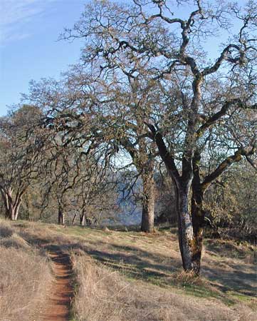
The oak trees were nice to hike past. The
tunnel was not too muddy, and it is dark inside. The trail is
much drier on the south facing slopes, headed down to the Confluence
Trail. On the Mammoth Bar access road, I partook of the facility,
near the pay station beyond the gate. With plenty of sunshine,
I slowed my pace and drank water, then my fruit soda.
The rays of the sun lit up the canyon,
and I could make out the Quarry on the other side. All in shadow,
I tried for a few photos. The river water was much clearer, being
the Middle Fork. Maybe being more, or less, of a wild river? Other
hikers enjoyed the fine weather. I sat, sunning myself, on a rock,
when a mountain biker chose to ride up next to me, where I hadn't
imagined a trail ran. He took the rocks very nicely, twice, and
I asked if I was blocking his way. He shortly went off, and I
continued down the single track.
As much as a music player would be nice,
it impedes the sounds of approaching bikes. I heard no number
of birds, or the sound of wildlife. Only the roar of the river,
and the rumble of traffic on the highways nearby.
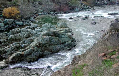 I
shot movies of the rapids in shadow, near the bottom of this hike.
The river is flowing nicely, and I had seen a kayak atop a passing
vehicle. But too cold, to me, to think of doing that, now.
I
shot movies of the rapids in shadow, near the bottom of this hike.
The river is flowing nicely, and I had seen a kayak atop a passing
vehicle. But too cold, to me, to think of doing that, now.
My total round trip time, over about 6 miles with 1,000' gain, came to almost exactly three hours.
I shot nearly 120 images and clips. My round trip drive was about
78 miles. I had gassed up, at 2.179, back when leaving town.
There was some late afternoon light to
shoot some of Auburn, but I have done that many a time. Not hungry,
I endured the traffic slowdowns to get home in time to watch the
evening news.
No ticks, but clouds of gnats. No lizards,
snakes, many birds, or any deer.
Another hike tomorrow, in this fine weather,
would be nice. But I am out of ops to get some gain, so close
to town. Maybe just another train ride out to the upper Parkway?
BACK TO PETE'S THOUSAND
PEAKS HOME PAGE